This is the part of the province where I grew up – in Clearwater BC, home to the Simpcw First Nation formerly known as the North Thompson Indian Band. My hometown is located in Wells Gray park, where you can find kikwilis (Indigenous dug out pit homes) along the Clearwater river. It is fascinating to imagine Indigenous people travelling down the Clearwater and the North Thompson River to get to Kamloops 150 years ago with fish and furs. When I was young, during spawning season the tranluscent Clearwater river turns from blue to red due to all the sockeye salmon. Now, due to climate change and overfishing there are only spots of red here and there. I also lived in Lytton for 2 summers and it’s a wonder how any one could live subsistently in this harsh desert climate – fishing is rich here too.
FN Population: 18,712
Total Pop’n: 520,800
Pop’n % FN: 3.59%
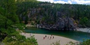
Stretching from Princeton and the Cascade Mountains in the west to the Monashee Mountains and the Alberta border in the east; and from the Washington state border in the south up to Mount Robson, the highest peak in the Rocky Mountains in the north. This area is renowned for its sunny climate, beautiful landscapes, and in the south, Canada’s only desert terrain. Approximately 3.43% of the Thompson Okanagan regional population are First Nations.
Towards the region’s western border lie the eastern reaches of the Sto:lo territory; in the south central portion of the region lies the traditional territories of the Nlaka’pamux and Okanagan, respectively centred around the Nicola and Okanagan valleys. Further north, towards and beyond Kamloops is traditional Secwepemc territory.
The original inhabitants of the Thompson Okanagan region relied heavily on its rivers, valleys and mountain passes, which provided “highways” to access the resources that sustained a productive and organized socioeconomic system. Salmon were fished from the rivers and streams, game was hunted in the forests, mountains and grasslands, and plants and medicines were gathered throughout the territory, all the while supporting a robust system of trade, kinship, and governance between neighbouring nations.As agriculture expanded in the fertile region, First Nations were forced off their land where the settler economy deemed necessary.
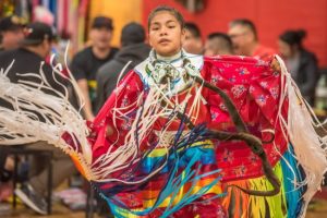
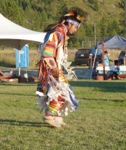
Noteworthy achievements in Indigenous economic reconciliation have been made, with numerous First Nations-led real estate development, hospitality, and tourism projects in the south-central part of the region setting a global example of what opportunities can be possible.
Shuswap Nation Tribal Council, also known as SNTC, was formed in 1980 as an effort of the Secwepemc chiefs to advance the issues and Aboriginal rights of the following Shuswap First Nations: Adams Lake, Bonaparte, Neskonlith, Shuswap, Simpcw, Skeetchestn, Splatsín, Tk’emlúps, Whispering Pines/Clinton. Note: several SNTC bands are located outside the Thompson Okanagan region.
Adams Lake
Language Group: Secwepemctsín
Adams Lake Development Corporation (ALDCO) is undergoing a restructuring process which has already produced measurable benefits. The two largest ALDCO operations are: a 10,000 sq ft covered mill; and a large prime lakefront development, West Harbour Village, in Salmon Arm. Adams Lake band has also entered into Forestry Consultation and Revenue Sharing Agreements with the Provincial government.
Ashcroft
Language Group: Nłeʔkepmxcín
The Ashcroft band has recently obtained high speed internet access for the community, as well as a large gas station compex development.
Bonaparte
Language Group: Secwepemctsín
As a member of the Shuswap Nation Tribal Council (SNTC), Bonaparte participates in larger Shuswap Nation economic development efforts, which include and Aboriginal Training and Employment Centre, as well as a Fisheries Commission that seeks to operate a sustainable commercial fishing operation in Kamloops Lake and the Thompson River.
Coldwater
Language Group: Nłeʔkepmxcín
Coldwater First Nation is a Nlaka’pamux First Nations government located in the Central Interior region of the Canadian province of British Columbia. We are a member of the Nicola Tribal Association,
Cook’s Ferry
Language Group: Nłeʔkepmxcín
Located in the Nicola Valley.
High Bar
Language Group: Secwepemctsín
Located in the Fraser Canyon-Cariboo region of the Central Interior of the Canadian province of British Columbia.The Secwepemc in the Fraser Canyon and on the Chilcotin Plateau are also known as the Canyon Shuswap and have traditionally had close ties with the Tsilhqot’in people.
Kanaka Bar
Language Group: Nłeʔkepmxcín
The Kanaka Bar Band is also known as T’eqt’ aqtn’mux or “the crossing place people”. It is a First Nations government located at Kanaka Bar, British Columbia, Canada, between the towns of Boston Bar and Lytton in the Fraser Canyon region.
Little Shuswap
Language Group: Secwepemctsín
The Little Shuswap Indian Band is a First Nations band government of a community of the Secwepemc (Shuswap) Nation, located in the Central Interior region of British Columbia, Canada. Its main reserve is in Chase, British Columbia, sometimes marked Squilax on maps (“black bear” in the Shuswap language) is properly called Quaaout, and is on the shore of Little Shuswap Lake.
Lower Nicola
Language Group: Nłeʔkepmxcín
Lower Similkameen
Language Group: Nsyilxcən
The Lower Similkameen Indian Band (LSIB) is a small, geographically isolated community in the Similkameen Valley, located in the South Central Interior of British Columbia.
The land base of the Lower Similkameen Indian Band is a combination of distinctive desert lands, luscious valley lands, mountainous alpine and fertile wetlands. The mountainous region contains various streams, creeks, rivers and lakes.
Lytton
Language Group: Nłeʔkepmxcín
As there are few sources of employment near the Lytton First Nation reserves, the Lytton First Nation Economic Development Department works to create employment opportunities for LFN membership.
Neskonlith
Language Group: Secwepemctsín
The Neskonlith Indian Band (sometimes Neskainlith) is a First Nations government in the Canadian province of British Columbia located in the Shuswap district east of Kamloops. It is on the outskirts of the small community of Chase, which has a population of about three thousand people.
Nicomen
Language Group: Nłeʔkepmxcín
Nicomen Indian Band is a Nlaka’pamux First Nations government located 17km East of Lytton BC, near the confluence of the Thompson and Nicoamen Rivers.
Nooaitch
Language Group: Nłeʔkepmxcín
Nooaitch First Nation is a Nlaka’pamux First Nations government in the Southern Interior region of British Columbia, Canada. The closest urban certain is Merritt.
Okanagan
Language Group: Nsyilxcən
The Okanagan Indian Band is located at the head of Okanagan Lake in Vernon, BC. There are currently about 1688 Okanagan Indian Band members.
Oregon Jack Creek
Language Group: Nłeʔkepmxcín
The Oregon Jack Creek Band is a small First Nations government in the Thompson Canyon area of the Southern Interior of the Canadian province of British Columbia. Its Indian Reserves and offices are located near the town of Ashcroft.
Osoyoos
Language Group: Nsyilxcən
Penticton
Language Group: Nsyilxcən
The Penticton Indian Band is a First Nations government in the Canadian province of British Columbia, located next to the city of Penticton in the Okanagan Valley. The Penticton Indian Band community members have declared that the Nation is the proper title and rights holders of the whole of the Okanagan territory.
Shackan
Language Group: Nłeʔkepmxcín
Simpcw First Nation
Language Group: Secwepemctsín
The Simpcw First Nation, formerly known as the North Thompson Indian Band, is a First Nations band government based in the Thompson Country of British Columbia, Canada.
Siska
Language Group: Nłeʔkepmxcín
The Siska First Nation is a Nlaka’pamux First Nations government located in the Fraser Canyon region of the Canadian province of British Columbia.
Skeetchestn
Language Group: Secwepemctsín
Located near Savona BC
Skuppah
Language Group: Nłeʔkepmxcín
located near Spuzzum, British Columbia.
Splatsin First Nation
Language Group: Secwepemctsín
The Splatsin are the most southern tribe of the Shuswap Nation, the largest Interior Salish speaking First Nation in Canada.
Tk’emlups te Secwepe’mc
Language Group: Secwepemctsín
Located near Kamloops BC.
Upper Nicola
Language Group: Nsyilxcən
Upper Similkameen
Language Group: Nsyilxcən
On top of the large touristic operations at the Mascot Mine, Upper Similkameen has interests in forestry in the Similkameen Valley.
The head offices are located in town of Hedley in the Similkameen Country.
Westbank First Nation
Language Group: Nsyilxcən
Westbank First Nation is a self-governing Nation in the Okanagan region of the Canadian province of British Columbia.
Located near Kelowna BC
Whispering Pines/Clinton
Language Group: Secwepemctsín
The Whispering Pines/Clinton Indian Band, also called the Pellt’iq’t First Nation is a member of the Secwepemc (Shuswap) Nation, located in the Central Interior region of the Canadian province of British Columbia. Its main Indian reserve is located near Barriere, BC.