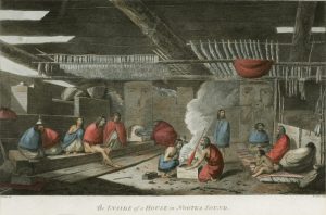
This was a really interesting region for me to learn about because I’ve lived on the island for 7 years and I was most interested to learn about the Indigenous communities around this area. I learned that there are quite a bit of Indigenous communities on the northern mid-northern coast of Vancouver Island that I didn’t even know existed before. They are quite isolated. I would love to explore more of this part of the island.
I also learned that the arts tradition is very strong on the coast as traditionally there was more time to spare from gathering food than say, northern communities. This is due to a less harsh climate and being so close to oceans and rivers with such abundance of food to harvest.
FN Population: 39,331
Total Pop’n: 759,400
Pop’n % FN: 5.18%
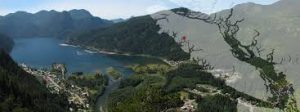
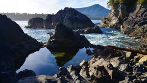
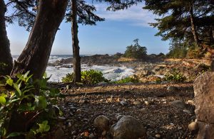
This region is known for its temperate climate, unspoiled wilderness and beautiful coastlines.
Many communities in these sparsely populated regions in the northern half of Vancouver Island and the mainland portion of the region are First Nations communities. Approximately 5% (39,300) of the regional population are First Nations. This is the highest absolute First Nations population of any region, although other regions have higher proportional First Nations populations, such as the North Coast, whose 35,300 First Nations residents make up over 60% of the total regional population.
Most First Nations in the Vancouver Island and Coast region are linguistically and culturally linked to groups in the Lower Mainland Southwest region — a result of the high levels of movement of people, goods, and knowledge throughout pre-colonial Salishian economy.
Ahousaht
Language Group: Nuučaan̓uɫ
The Ahousaht First Nation is a First Nation government based on the west coast of Vancouver Island in British Columbia, Canada, focused on the community of Ahousaht, British Columbia. It is the largest member of the Nuu-chah-nulth Tribal Council. Almost 2,400 proud Ahousaht members live all across Vancouver Island, on the Mainland of BC, and even in parts of Washington State. Its administrative centre, the village of Maaqutusiis, is located on Flores Island, near Tofino, and is the primary home of the people of Ahousaht.
Cowichan Lake
Language Group: Diitiidʔaatx̣
Located near Duncan, and the south end of Cowichan Lake
Cowichan Tribes
Language Group: Halq’eméylem hən̓q̓əmin̓əm̓ Hul’q’umi’num’
Located in Duncan BC
Da’naxda’xw First Nation
Language Group: Kwak̓wala
The Da’naxda’xw Nation is a First Nation government in northern Vancouver Island, British Columbia. Its main community is in Alert Bay, in the Queen Charlotte Strait region.
Ditidaht
Language Group: Diitiidʔaatx̣
The Ditidaht First Nation is a First Nations band government on southern Vancouver Island in British Columbia, Canada. Its reserves and traditional territory are generally west of Port Renfrew and East of Barkley sound.
Dzawada’enuxw
Language Group: Kwak̓wala
The Dzawada’enuxw First Nation is a First Nations band government in the Queen Charlotte Strait region north of northern Vancouver Island .
Ehatteshaht
Language Group: Nuučaan̓uɫ
The Ehattesaht First Nation is a First Nations government based on the north west coast of Vancouver Island in British Columbia. We are a small nation with a large traditional territory of over 66,000 ha on the North West Coast of Vancouver Island.
Esquimalt
Language Group: Lkwungen Malchosen Semiahmoo SENĆOŦEN T’Sou-ke
The Esquimalt First Nation, is a First Nations government of the Esquimalt people. Historically their village was located closer to Victoria proper, but today their main reserve is on the north shore of Esquimalt Harbour adjacent to the Town of View Royal. The Esquimalt Nation is a small nation with approximately 150 members living on reserve and another 100 living off reserve.
Gwa’sala-Nakwaxda’xw Band
Language Group: Kwak̓wala
The Gwa’sala-Nakwaxda’xw is a small, semi-rural community of about 500 on-reserve community members. Near Port Hardy on the North-eastern tip of Vancouver Island, British Columbia.
Gwawaenuk Tribe
Language Group: Kwak̓wala
Also known as, Gwawa_enux_w, the Gwawaenuk Tribe is a First Nations band government of the Kwakwaka’wakw people located in the Queen Charlotte Strait region of the Central Coast region of British Columbia, Canada. The Gwawaenuk Tribe is off-grid, and is generally a water access community.
Halalt
Near Chemainus BC
Heiltsuk
Language Group: Hailhzaqvla
Near Bella Bella BC. The Heiltsuk First Nation is party to a number of agreements with the Provincial Government regarding the ongoing and proposed LNG developments in its traditional territory.
Hesquiaht
Language Group: Nuučaan̓uɫ
Based on the west coast of Vancouver Island in British Columbia, Canada. Hesquiaht First Nation is the most northerly and also the most remote of the Nuu-chah-nulth Nations in the Clayoquot Sound. (North of Tofino).
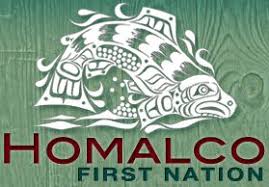
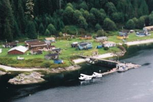
Homalco
Language Group: Éy7á7juuthem
The Homalco First Nation is a First Nations government located in Bute Inlet near the upper Sunshine Coast of British Columbia, Canada. Homalco First Nation are traditionally known as the “People of fast running waters,” named after the turbulent waters surrounding our original home in Bute Inlet. Near Campbell River BC.
Hupa¢asath First Nation
Language Group: Nuučaan̓uɫ
Located in Port Alberni BC
Huu-ay-aht First Nation
Language Group: Nuučaan̓uɫ
Huu-ay-aht First Nation is a self-governing, modern treaty Nation whose lands are located in the Barclay Sound region on the west coast of Vancouver Island. Located in Pacific Rim National Park, south of Bamfield.
K’ómoks First Nation
Language Group: Éy7á7juuthem Kwak̓wala Pəntl’áč
The K’ómoks First Nation, also known as the Comox Indian Band, is the band government of the Island Comox or K’ómoks people of Vancouver Island, British Columbia. For thousands of years indigenous people occupied the shoreline of eastern Vancouver Island in a place referred to as, “the land of plenty”. This Land of Plenty stretched from what is known today as Kelsey Bay south to Hornby and Denman Island and included the watershed and estuary of the Puntledge River.
Ka:’yu:’k’t’h’/Che:k:tles7et’h’ First Nations
Based at Kyuquot, located on the outer coast of Kyuquot Sound, on the west coast of Vancouver Island in British Columbia.
Klahoose First Nation
Language Group: Éy7á7juuthem
Traditional territories are located on Cortes Island at the northern end of the Strait of Georgia, and surrounding Toba Inlet, British Columbia.
Kwakiutl
Language Group: Kwak̓wala
Located near Port Hardy in the Queen Charlotte Strait region.
Kwiakah
Language Group: Kwak̓wala
Most band members live in Campbell River but the traditional territory is in the Discovery Islands to the north of that city and their two Indian Reserves are located on the mainland coast adjacent to that archipelago. The band is making an effort to “go back to the land” and re-occupy their traditional sites.
Kwicksutaineuk-ah-kwaw-ah-mish
Language Group: Kwak̓wala
Located on Alert Bay, south of Port McNeil
Lyackson
Language Group: Halq’eméylem hən̓q̓əmin̓əm̓ Hul’q’umi’num’
located at Chemainus, British Columbia, Canada, on Vancouver Island. Valdes Island is the centre of the Lyackson community and our Nation finally has full control over this territory of ours.
Malahat First Nation
Language Group: Halq’eméylem hən̓q̓əmin̓əm̓ Hul’q’umi’num’ Lkwungen Malchosen Semiahmoo SENĆOŦEN T’Sou-ke
The Malahat First Nation is a First Nations government located on southeastern Vancouver Island in southwestern British Columbia. Located near Mill Bay.
Mamalilikulla-Qwe’Qwa’Sot’Em Band
Language Group: Kwak̓wala
The home territory of the Mamalilikulla and Qwe-Qwa’Sot’Em groups of Kwakwaka’wakw was in the maze of islands and inlets of the eastern Queen Charlotte Strait region around the opening of Knight Inlet, mainly on Village Island, where their principal village Memkumlis is (often known by the name Mamalilikulla).
Mowachaht/Muchalaht
Language Group: Nuučaan̓uɫ
Located on the west coast of Vancouver Island. The Nation’s centre is known as Yuquot, which means “Friendly Cove,” historically allowed multiple tribes to gather during the summer harvest season as one large confederacy of strength, commerce and hospitality. This rich culture continues today with the Mowachaht/Muchalaht First Nations opening up the Yuquot Historic Village site for the entire world to come and experience their history and culture. Yuquot village has been designated as a National Historic Site.
Nanoose First Nation
Language Group: Halq’eméylem hən̓q̓əmin̓əm̓ Hul’q’umi’num’
The Nanoose First Nation, also known as the Snaw-Na-Was First Nation, is a First Nations government located on southern Vancouver Island in southwestern British Columbia, Canada, in the vicinity of the Nanoose Bay, situated 30 minutes north of Nanaimo, B.C. Along with 18 other tribes in the Salish Sea we are Coast Salish people, one of the northern most tribes on the east side of Vancouver Island.
Namgis First Nation
Language Group: Kwak̓wala
Located on the north side of Alert Bay.
Nuchatlaht
Language Group: Nuučaan̓uɫ
Nuchatlaht is a small community located approximately 3 hours west of Campbell River in a remote portion of Vancouver Island. It is a member of the Nuu-chah-nulth Tribal Council which consists of 14 communities along the western portion of Vancouver Island. Located near Fair Harbour.
Nuxalk Nation
Language Group: Nuxalk
The Nuxalk Nation is the government of the Nuxalk people of Bella Coola, British Columbia.
Pacheedaht First Nation
Language Group: Diitiidʔaatx̣
Pacheedaht territory includes the lands and waters along the southwest coast of Vancouver Island between Bonilla Point and Sheringham Point (see Map). The name “Pacheedaht” translates to English as “Children of the Sea Foam.” Located north of Port Renfrew.
Pauquachin
Language Group: Halq’eméylem hən̓q̓əmin̓əm̓ Hul’q’umi’num’ Lkwungen Malchosen Semiahmoo SENĆOŦEN T’Sou-ke
Located in North Saanich, Victoria.
Penelakut Tribe
Language Group: Halq’eméylem hən̓q̓əmin̓əm̓ Hul’q’umi’num’
Located on Penelakut Island, south of Thetis Island.
Qualicum
Language Group: Halq’eméylem hən̓q̓əmin̓əm̓ Hul’q’umi’num’
The Qualicum First Nation is a First Nations band government located in Qualicum Bay at the mouth of the Big Qualicum River, 15 minutes north of Qualicum Beach on Vancouver Island.
Quatsino
Language Group: Kwak̓wala
Based in the Quatsino Sound region on the west coast of northern Vancouver Island in British Columbia, near Coal Harbour.
Scia’new
The Scia’new First Nation, also known as Beecher Bay, is a band government located on southern Vancouver Island in southwestern British Columbia, Canada. The Sc’ianew (Cheanuh) First Nations’ main community is on Beecher Bay in East Sooke. They can trace their ancestry to people who spoke four different languages. The English translation of the name means “big fish”. The predominant language is now Hul’q’umi’num’.
Snuneymuxw First Nation
Language Group: Halq’eméylem hən̓q̓əmin̓əm̓ Hul’q’umi’num’
Snuneymuxw territory encompasses one of the most productive and resource rich areas at the heart of the Salish Sea. Located south of Nanaimo.
Songhees
Language Group: Lkwungen Malchosen Semiahmoo SENĆOŦEN T’Sou-ke
The Songhees or Songish, also known as the Lekwungen or Lekungen, are an indigenous North American Coast Salish people who reside on southeastern Vancouver Island, British Columbia in the Greater Victoria area. Located adjacent to the Township of Esquimalt and the Town of View Royal. The community is comprised of five main families and several smaller families.
Stz’uminus First Nation
Language Group: Halq’eméylem hən̓q̓əmin̓əm̓ Hul’q’umi’num’
Located near Ladysmith BC.
T’Sou-ke First Nation
Language Group: Lkwungen Malchosen Semiahmoo SENĆOŦEN T’Sou-ke
T’Sou-ke operates a number of projects, including the Sooke Potholes Regional Park, the Spring Salmon Place Campground, Salish Straits Seafoods, a solar project which provides power to the entire community and sells power to the regional grid, a commercial greenhouse, and a partnership in a wind power development.
Tla-o-qui-aht First Nations
Language Group: Nuučaan̓uɫ
Located north of Tofino.
Tla’amin
Language Group: Éy7á7juuthem
Tla’amin Nation resides just north of the city of Powell River in British Columbia, along Highway 101. Our Nation is one of the many indigenous Coast Salish tribes inhabiting the Pacific Northwest Coast. Located north of Powell River.
Tlatlasikwala
Language Group: Kwak̓wala
Our home village is at beautiful Bull Harbour on Hope Island. Our peoples originated from spiritual places in our Territory, places we hold sacred today. Our peoples numbered in the thousands until contact with sailing vessels 200 years ago. We had no immunity to the introduced diseases. Today the survivors number 65 and we are working hard to re-build our community.
Tlowitsis Tribe
Language Group: Kwak̓wala
The Tlowitsis Nation, formerly the Tlowitsis Tribe, is the Indian Act band government of the _awit’sis (Tlowitsis) tribe of the Kwakwaka’wakw peoples, located in the Queen Charlotte Strait-Johnstone Strait area in the Discovery Islands between Vancouver Island and the British Columbia mainland in Canada. Tlowitsis territory covers parts of northern Vancouver Island, Johnstone Strait, and adjoining inlets of the mainland. Kalugwis, on Turnour Island, was their principal community in times past.
Toquaht
Language Group: Nuučaan̓uɫ
The Toquaht Nation is a self-governing Treaty Nation of the Maa-nulth First Nations (MFN) Final Agreement, giving them the authority to determine land-use planning and zoning, including sub-division approval, on our land base.
Tsartlip
Language Group: Lkwungen Malchosen Semiahmoo SENĆOŦEN T’Sou-ke
The Tsartlip First Nation is a First Nation located on the Saanich Peninsula, in Saanich territory on Vancouver Island. Located near Brentwood Bay.
Tsawout First Nation
Language Group: Lkwungen Malchosen Semiahmoo SENĆOŦEN T’Sou-ke
Located in North Saanich.
Tseshaht
Language Group: Nuučaan̓uɫ
Located near Port Alberni.
Tseycum
The Tseycum First Nation is a First Nations government located on southern Vancouver Island near Victoria. Tseycum (Union Bay Indian Reserve No.4) is one of the four Saanich villages of Southern Vancouver Island, located at the centre of Patricia Bay on the Saanich Peninsula. In the Sencoten langauge Tseycum is spelled Wsikem and means Land of Clay. Located near Victoria airport.
Uchucklesaht
Language Group: Nuučaan̓uɫ
The Uchucklesaht First Nation is a First Nations government based on the west coast of Vancouver Island in British Columbia. The Uchucklesaht Tribe has two villages that are situated approximately 24 miles down the Barkley Sound, southwest from Port Alberni. The first village is immediately past the Uchucklesaht Inlet on the West side of Barkley Sound, named “Cowishulth”. The second village is located at the head of Uchucklesaht Inlet and is named “Hilthatis”.
We Wai Kai
Language Group: Kwak̓wala
Also known as the Cape Mudge First Nation. Based on Quadra Island offshore from Campbell River. The We Wai Kai Nation/Cape Mudge Band current population is approximately 1100 Citizens, about 1/2 live on reserve (split between Cape Mudge Village and Quinsam Reserve), and the other 1/2 live off reserve. It has 4 reserves on Quadra Island, and one within the city limits of Campbell River.
Wei Wai Kum
Language Group: Kwak̓wala
The Campbell River First Nation (Wei Wai Kum) are a band government based at the city of Campbell River. As part of the Wei Wai Kum First Nation, the Campbell River Indian Band provides housing opportunities, education, health care information and ongoing support for Band members.
Wuikinuxv Nation
Language Group: ’Uik̓ala Oowekyala
The Wuikinuxv Nation, also known as the Oweekeno Nation, is a First Nations government whose traditional territory is the shores of Rivers Inlet and Owikeno Lake in the Central Coast region of the Canadian province of British Columbia, in the area south of Bella Bella and north of Queen Charlotte Strait. Located on the north western coast of BC.
Yuu_u_i__at_ Government(Ucluelet First Nation)
Language Group: Nuučaan̓uɫ
The Ucluelet First Nation, is the government of the Yuu_u_i__at_ people, located on the west coast of Vancouver Island on the northwest side of Barkley Sound.
Nick Kruks
October 22, 2019 — 3:48 pm
Wow amazing wealth of info here! Thanks for posting. I’ll be using these resources in the future for sure
beau
October 22, 2019 — 7:39 pm
Thanks Nick! Most of it is from the FNESC website. They have a great interactive map
https://waterfallmagazine.com
July 20, 2020 — 2:48 pm
https://waterfallmagazine.com
Very nice article, just what I needed.